Day 5 Tuesday 24/7/18
The day before the BIG day!!! Getting very excited....
 |
| Stunning dawn over Exmouth Gulf (view from our balcony) |
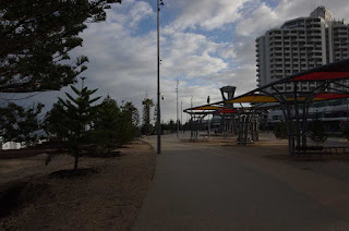
 |
| Collection of domes - part of Solar Observatory |
Decided on a relaxing day today, went for a shortish drive south of Exmouth
for about 35Km, first stop to look at the Solar Observatory, its all behind fences and little signage!! We couldn’t get in
although it has an interesting collection of domes and radio discs but NO
visitors centre...come on guys people are interested - if you build it we will come!! We then headed of to Learmouth.
 |
| Oil rigs in Exmouth Gulf (view from Learmouth Jetty) |
Then went to the Krait and Potshot
Memorial. The Krait was a Japanese fishing boat which the Australian Special
Forces captured in WWII and used to conduct a sneak raid of the Japanese fleet in Singapore harbour, sinking about
35,000 tons of Japanese vessels.
 |
| Remains of steel ball used as buoy for the submarine base |
The Potshot Memorial tells the story of the American base
setup during WWII as a forward fueling base. It was incredibly well stocked
compared to the Australian Base. This led to a lot of the US troops taking in the Aussie
troops and opened up supplies of food, beer etc. The US Supply canteen had a policy that
once it was at break even point with recouping its costs it gave away its stock
until the next shipment came in and it had to charge the troops for luxury
items. This lead to some spectacular parties apparently when free beer became
available.
 |
| Display is very informative - Dale is deeply fascinated. |
 |
| Sculpture depicting the many gun emplacements that protected the base |
From here we visited the Charles Knife Gorge Road. This
road was surveyed by Charles Knife, who was not a surveyor but his boss decided
he was perfect for the job as a surveyor would just say it was impossible. The
road was put in by the WAPET company, later taken over by Chevron (Ampol in
Australia) to explore for possible oil in the ranges. This was unsuccessful and
oil was ultimately found in at Barrow Island and later the in the Gulf.
The tourist
road heads up into the hills, however is a magnificent legacy.
 |
| One of the many gorges viewed from Charles Knife Road |
 |
| Erosion and cracks in the stone |
 |
| View back towards Exmouth Gulf from Charles Knife Gorge Road |
 |
| Further along - amazing scenery |
 |
| Elevation goes quite abruptly from sea level plain at around 15M to up on the range at around 300M, and we didn't get to the top as the road became a little rough and unsealed. |
Moving further north of Exmouth we visited the Vlamingh Head
lighthouse and radar station and then retraced our steps via the wreck of the SS
Mildura to Exmouth.
 |
| Hard to see but this is the VLF listening station first used during the Cold War. The main tower (in the centre) is supposedly the second tallest structure in the Southern Hemisphere at 389M. |
 |
| View from Vlamingh Head lighthouse |
 |
| Vlamingh Head lighthouse |
 |
| Local flora in flower. |
 |
| Remains of radar station and WWII sand bags at Vlamingh Head |
 |
| Whale breaching in the Indian Ocean just off Vlamingh Head |
 |
| Wreck of SS Mi;ldura which prompted the building of the lighthouse at Vlamingh Head |
 |
| Surf breaking on the reef off Vlamingh Head |
 |
| Seals frolicking in the bay on their way out to the shelf |
 |
| Sea birds..... |
 |
| Camels came to visit again |
 |
| Interesting sky colour at sunset (view from our balcony) |


Comments
Post a Comment